
H2S radar and the Navigation and Bombing System

If you remember one fact about Vulcan radar, remember this: the bomber was aimed by a ground-mapping set inherited from the Second World War and married to analogue computers. The set was H2S. The marriage was the Navigation and Bombing System, NBS. Together they were the reason the nose is a radome and the reason three of the five crew sat facing backwards in the dark.
What H2S was
H2S began in the 1940s as a centimetre-wave radar that painted a crude map of the ground on a cathode-ray tube — cities as bright blobs, rivers as dark threads, coastlines as edges. By the time it reached the V-Force as H2S Mk 9 (and later 9A/9B depending on modification standard), it was a much more capable X-band mapping radar, still doing the same conceptual job: tell the navigator what the earth looked like through cloud, night and distance.
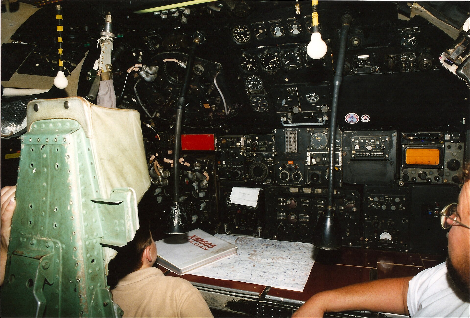
On the Vulcan the scanner lived in the large dielectric nose radome, ahead of the cockpit. The picture appeared at the Navigator Radar’s station in the rear cabin. It was not a modern digital map. It was a skill. Interpreting H2S — distinguishing a bend in a river from a bend in a railway, knowing how a particular city bloomed on the tube at a given range and grazing angle — was a trade taught on the OCU and honed on exercises.
The Navigation and Bombing System
NBS was the British answer to “how do we get a jet bomber to a point in the Soviet Union and release a weapon without seeing the ground?” It combined:
- H2S for position fixing and bombing
- Green Satin Doppler radar for velocity and drift
- Analogue computing to dead-reckon between fixes and to solve the bomb-release problem
- The Navigator Plotter’s charts, astro and radio aids as the human audit of the machines
In a radar-bombing run the aircraft did not need a visual sight of the target. The NBS computed a release point from the radar-derived position, heading, speed and the ballistic properties of the store. Visual bombing, through the nose position shown above, was the exception — useful in training and in conventional operations such as Black Buck, where the crew still leaned on H2S to find a small airfield at the end of an enormous flight.
Who did what
The Navigator Radar owned the H2S. He identified ground features, took fixes, and ran the bombing side of the NBS. The Navigator Plotter kept the navigation plot, cross-checked, and handled the traditional tools — the things that still worked if a box failed. The pilots flew headings and heights the system asked for. The AEO listened to the electronic war and ran the defensive suite described under ECM.
This division of labour is why a Vulcan cockpit photograph can mislead. The flight deck is dramatic. The mission was run downstairs.
Limits
H2S could be jammed, spoofed by weather, or simply confusing over uniform terrain. NBS was analogue: brilliant for its decade, maintenance-heavy, and not a GPS. Crews practised until the combination of radar picture, Doppler and plot was good enough for the war plan. When the force went low-level, H2S did not vanish — mapping still mattered — but it was joined by a separate terrain-following radar looking ahead at the hills rather than down at the cities.
| Role | Ground mapping, position fixing, radar bombing |
|---|---|
| Family | H2S Mk 9 series in the NBS |
| Location | Main nose radome |
| Primary operator | Navigator Radar |
| Partners | Green Satin Doppler, analogue NBS computers, plotter’s chart |